
A PDF version is available here.
We turn now to Pont d’Avignon, properly known as Pont Saint-Bénézet, the primary interest of the IBG trip. Those who learned French at school will likely be aware of this bridge from the song – German was my language of choice, and I was quite ignorant of both.
Its most striking feature now is its length, or lack of it. Only three river spans remain of around 20.

The end span stands happily, indicating that the piers, though very much narrower as a proportion of span than those of many medieval bridges, are wide enough to act as full abutments. Each span is an independent bridge.

The 1608 drawing by Étienne Martellange, right, shows the indirect course of the bridge, which originally linked shallows or islands. It also shows several spans missing.
The first bridge was built here in the 12th century. The bridge of which a fragment is left dates to the 13th century, after the original was destroyed in the siege of Avignon. Legend has it that Bénézet, a shepherd, believed he had been commanded by Jesus to build a bridge here. Remarkably, the Bishop and wealthy funders were convinced to support the project; apparently because 18 miracles occurred when Bénézet laid the first stone. He died before the bridge was complete, and is now the patron saint of bridge builders.

The bridge survived from the 13th century to the 16th intact, no doubt with periodic rebuilding of spans lost to the ferocious floods that would have occurred here. Those floods also moved the islands around. L'Île de Piot is now continuous across the old course of the bridge.
Repair then stopped, and by 1685 the map left shows 10 spans collapsed.
The first river pier supports a chapel, seen below from the river bank. Bénézet’s remains were buried here until 1669. The chapel now is rather muddled, having clearly been modified several times.
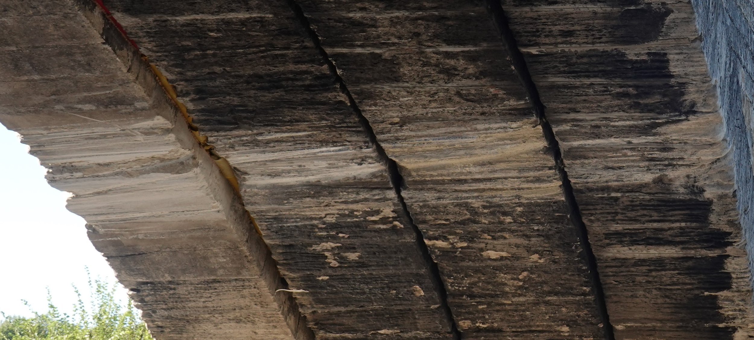
Notice that the arch itself is of independent rings with no bond. This style of construction matches that of the Pont du Gard – but Pont Julien, featured last month, had a bonded ring.


Close inspection reveals that a single course of three longer stones provided some bond at low level. At the river bank (right, viewed from the chapel pier) these have fractured at the main joints. At the chapel end of the same span (below) the damage is less complete and the distinct course more obvious.

There is a definite tendency for the separate rings to separate at the crown. That this separation is so slight may be a result of the lack of freeze thaw and the fact that the bridge has never experience significant live loads.


The end span (above left) looks rather less happy, having suffered repeated attack by motor vehicles. I suppose it gave as good as it got, but has this been enough to drag the leftmost ring away from the rest? The wide joint (enlarged below) is stuffed with corrugated pipe and expanding foam. An unsympathetic treatment perhaps intended to stop fill material (above right) dropping through.
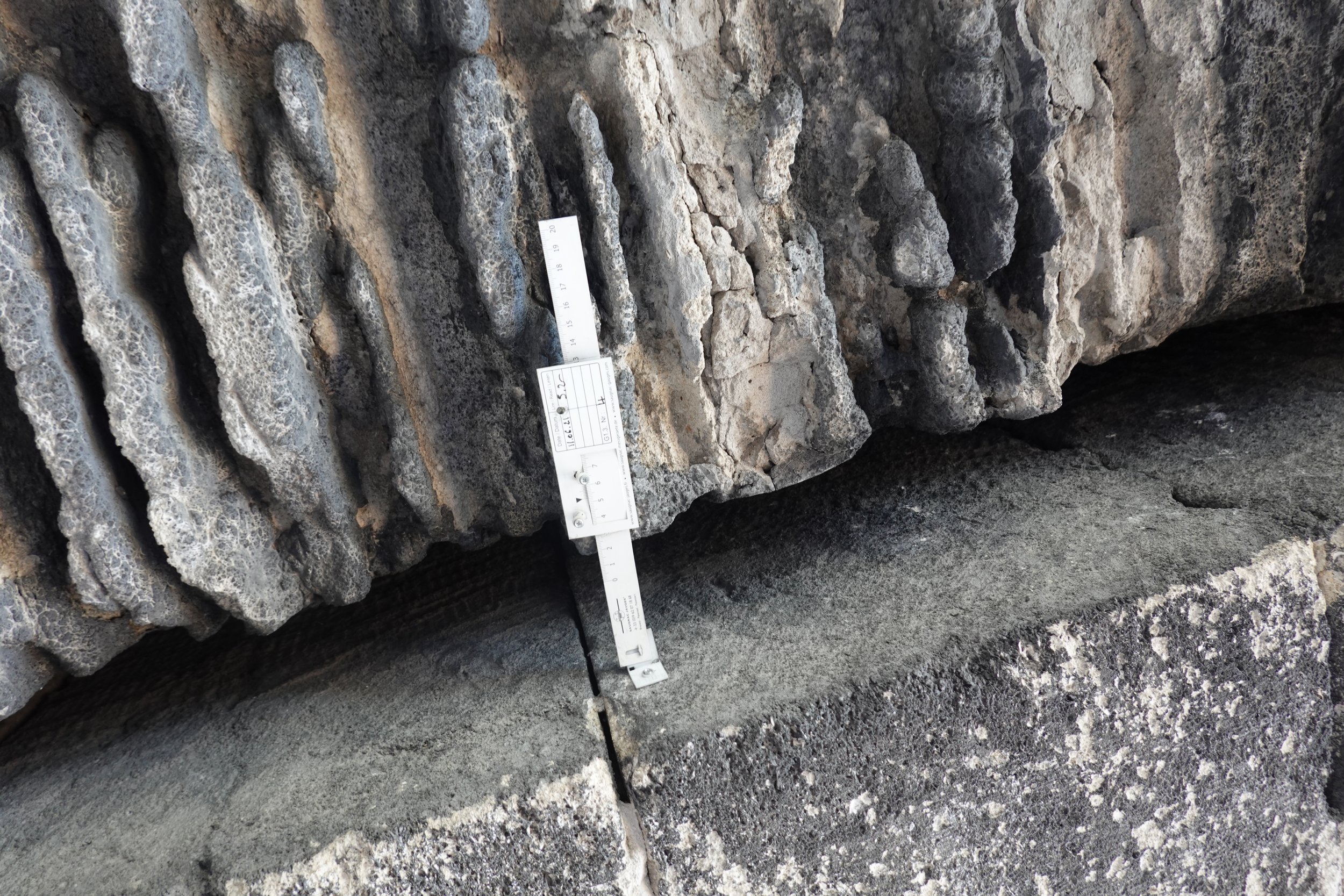
Where that fill is visible from the footpath, as above, it seems to be in the form of quite small shards of stone with no mortar, so the fear of pieces dropping out is not unfounded.
Several tell-tales have been installed, of a “flexible tape and Vernier scale” type. Interesting that the initial reading recorded is given to one decimal place, rather than the two allowed by the Vernier. I didn’t take the liberty of tensioning the tape to check the current reading, so it might not be indicating a 0.5mm movement in two years as it appears.

That outer ring is much less eroded than its deeply-grooved neighbour. It also sits lower through most of the span. What is going on? My first thought was that this was something to do with the plan step at the river end of this span (below). But that goes the wrong way!
So perhaps it is a replacement for an earlier edge ring that failed.
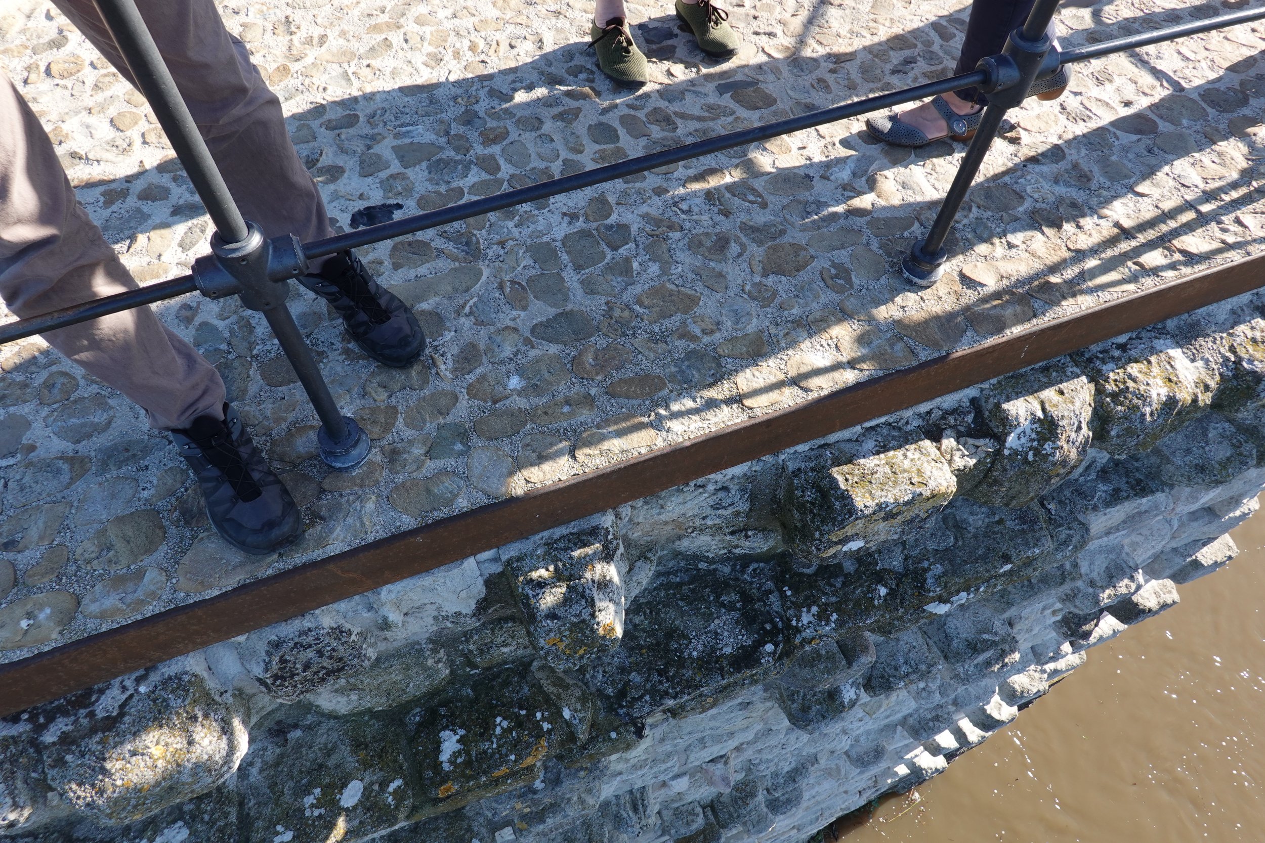
Back out over the water, the starlings are skew to the bridge. Built, I suppose, to match the flow direction, which has since changed.


The spandrel walls of the river spans are a patchwork of repairs as we would expect. The starlings are faced in very different material, a repair from a less sympathetic era.

The arch over the pier saves a bit of material in construction, and allows a little flow in spate (the Rhône is heavily managed now, and the climate is different, so floods much less severe). Do we suppose the spandrels are filled, or are there hidden voids? It would be odd to include transverse voids but close them to flow.
The masonry over the final pier is quite different. There is also no flood arch here. Is this older, or has it been rebuilt to better protect the remains of the bridge?

Those photos give a good impression of scale. Wikipedia has the longest extant span at 36m. The audacity of this, given the time and the setting, is quite something.
A limited view down the end face shows solid bonded masonry on a perfect vertical break. Not necessarily what we would expect to find.

The view as we climb to the Jardin des Doms shows the Île de Piot in the middle distance. The Tour Philippe-le-Bel, just above the line of the bridge in the distance, sits close to the far bank of the river, near where the bridge ended.
From there, Avignon and the Palais des Papes make a striking scene. The bridge is hidden by the trees.

Pont d’Avignon was subject to an intensive research programme around a decade ago, with some publications in English.
A 3D reconstruction was developed then, which is presented in the visitor centre. Sadly, it doesn’t appear to be available online.