
A PDF version is available here.
Heather and I spent the weekend of 20 October in Avignon with a wonderful group of enthusiasts for old bridges. The main subjects of interest were Pont Saint-Bénézet (Pont d’Avignon) itself, Pont du Gard, and Pont Saint Esprit (upriver from Avignon in the commune of the same name). I’ll get to each of those over the next few months.

On the way back to the airport, we detoured via Roussilon for the spectactular ochre deposits, …
… and Pont Julien, a well preserved Roman bridge dated rather precisely to 3 BCE.


The bridge rises to a point over the crown of the larger central span. A smaller span each side defines the slope. A bypass was built in 2005 to take vehicular traffic off the bridge,
which is still used by cyclists and pedestrians. Cycle routes in the area around Avignon are notably well used.
The openings over the piers are reasonably interpreted as providing for increased flood conveyance, though the effect is surely limited. This is clearly a valley that carries large flows at times, though it was completely dry for our visit despite recent heavy rain in the area.

The ring of the main span is entirely of large blocks. Unlike Pont du Gard and the two medieval bridges we visited, these are bonded in the width, if only slightly, suggesting that a full width centre was used for construction.
The piers are fairly stocky – though not as wide relative to the span as many medieval bridges in the UK – and it might have been possible to build a single span and strike the centre, but the distinct radii of the side and centre arch means at least two centres would have been needed here in any case.
The side spans have areas of small blocks over the crown. These are irregular, and not symmetrical around the crown, and are surely repairs. Within the small block masonry sections have been replaced again. Notice the stones placed longitudinally at the far side.


The flood arches are of undressed pebbles with dressed voussoirs only. Rubble concrete fill was used at an aqueduct structure near the Pont du Gard, this (through a long telephoto lens) looks rather similar. The crown voussoir is displaced.

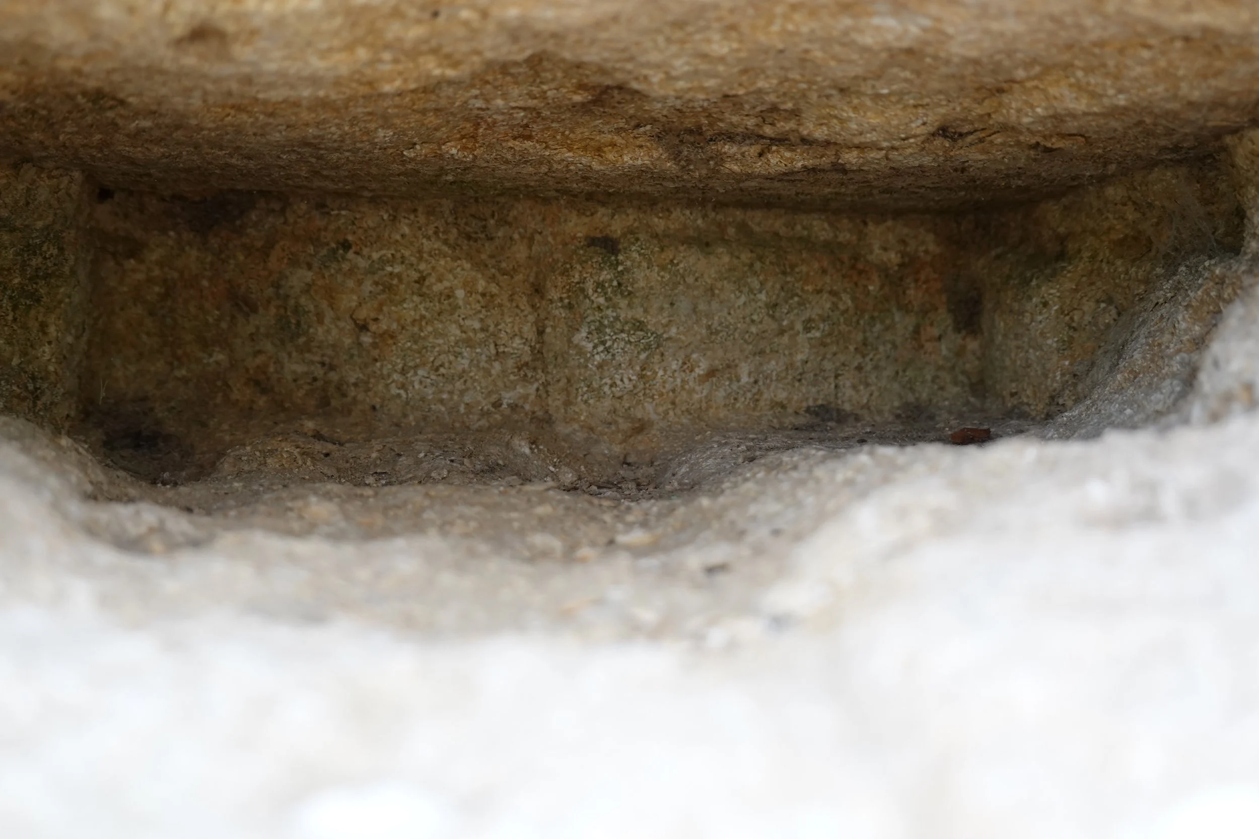
The corner of one pier is of quite different stone, a greensand. The information board states that the piers were built over remains of an earlier bridge. Preserving just these stones would be a strange thing to do, aesthetically (which clearly mattered to the builders) and structurally.
There are many holes in the stonework. These all lie in the lower parts of the bridge. From the number and pattern they are not putlog holes to support centring and scaffold. The holes coincide systematically with the intersection of bed and perpend joints. In odd places, two of the holes extend along one or other joint and connect. I suppose these are erosion from flood flows. The bite from the right hand edge is where a cutwater has been lost.

Dressed masonry is visible behind. This contrasts with typical masonry construction over the last few hundred years at least, when in internal construction would be of undressed rubble. Rubble concrete is used internally at small structures near Pont du Gard and in the flood relief arches here, so it is interesting that the lower part of the pier is dressed stone within.

The upriver pier faces show clear evidence that these were once cutwaters of dressed, bonded masonry. Were they slowly eroded by flows, or quarried for the stone? Either way, the current bridge feels more exposed to damage from high flow than it should be.
The step in the water run is because a corner has been lost. Flow from above drips off, but water running down the face tracks in again.
The parapet stones are more recent. The interlock is delightful. The same feature appears on the 18th C “pont moderne” at Pont du Gard.

The parapet stones cut into the crown of the flood arches and even slightly into the main span. That surely isn’t original – perhaps the road was reprofiled to reduce the gradients.


The parapet stones are largely above road height, vehicle loads would have been applied directly to the arch rings at the crown. The main arch ring is either undamaged despite this, or was repaired in matching large blocks.
In the side spans, I think the small block repairs are asymmetrical, in both cases to the outer side. At the south side the offset is small, at the north, much greater. Cover is lower downhill from the crown, though only slightly, and that probably isn’t enough to explain the north side.

This is the north side of the north span. Notice the crack through the inner edge of the near voussoirs top right.
Masonry is very stiff, but differences in stiffness dominate much real behaviour. Force follows stiffness should be front of mind when interpreting masonry behaviour and damage.
We would normally expect (though this is not allowed in assessment models) concentrated loads applied to the ring to distribute in the masonry toward the springing, just as concentrated loads on a wall spread. Here the reverse is happening; the stresses are gathering to the stiff point. The stone, after all, doesn’t know which way is up.
The load perhaps built up gradually as mortar washed out of the patch. With vehicular loading it would also have had a cyclic component. The crack wanders through the stone. It also bifurcates, with a finer crack continuing parallel to the edge while the now larger crack heads out to the left. Both of these features suggest that the crack started small and was propagated by cyclic loading.
And finally … Surface erosion reveals the structure of the rather beautiful shelly limestone.

