
A PDF version is available here.
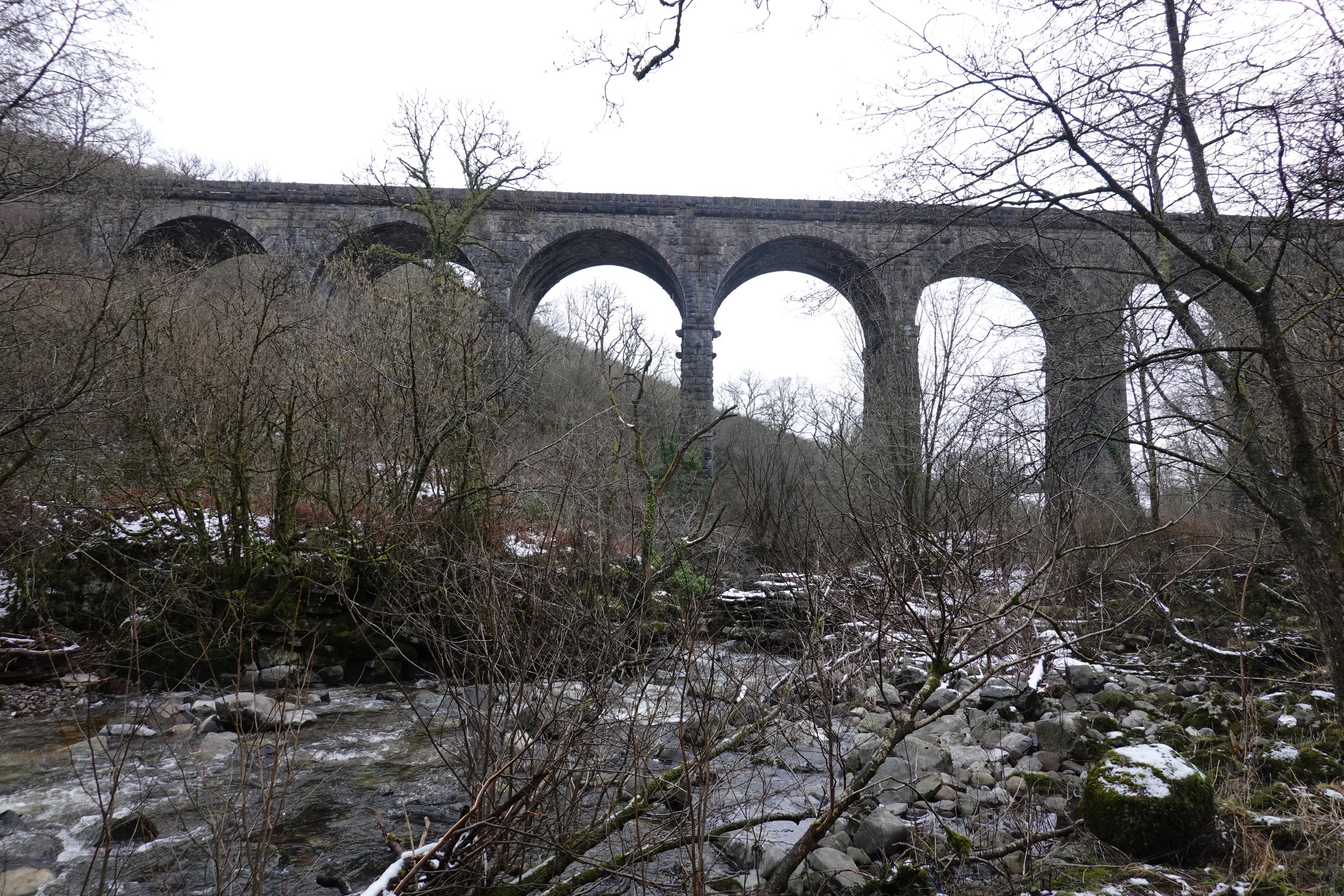
Pontsarn Viaduct, on the edge of Merthyr Tydfil, was built in the 1860s to carry the Brecon and Merthyr Railway over the Afon Taf Fechan, which flows here in a fairly steep sided valley. It is a spectacular structure, in need of some TLC.
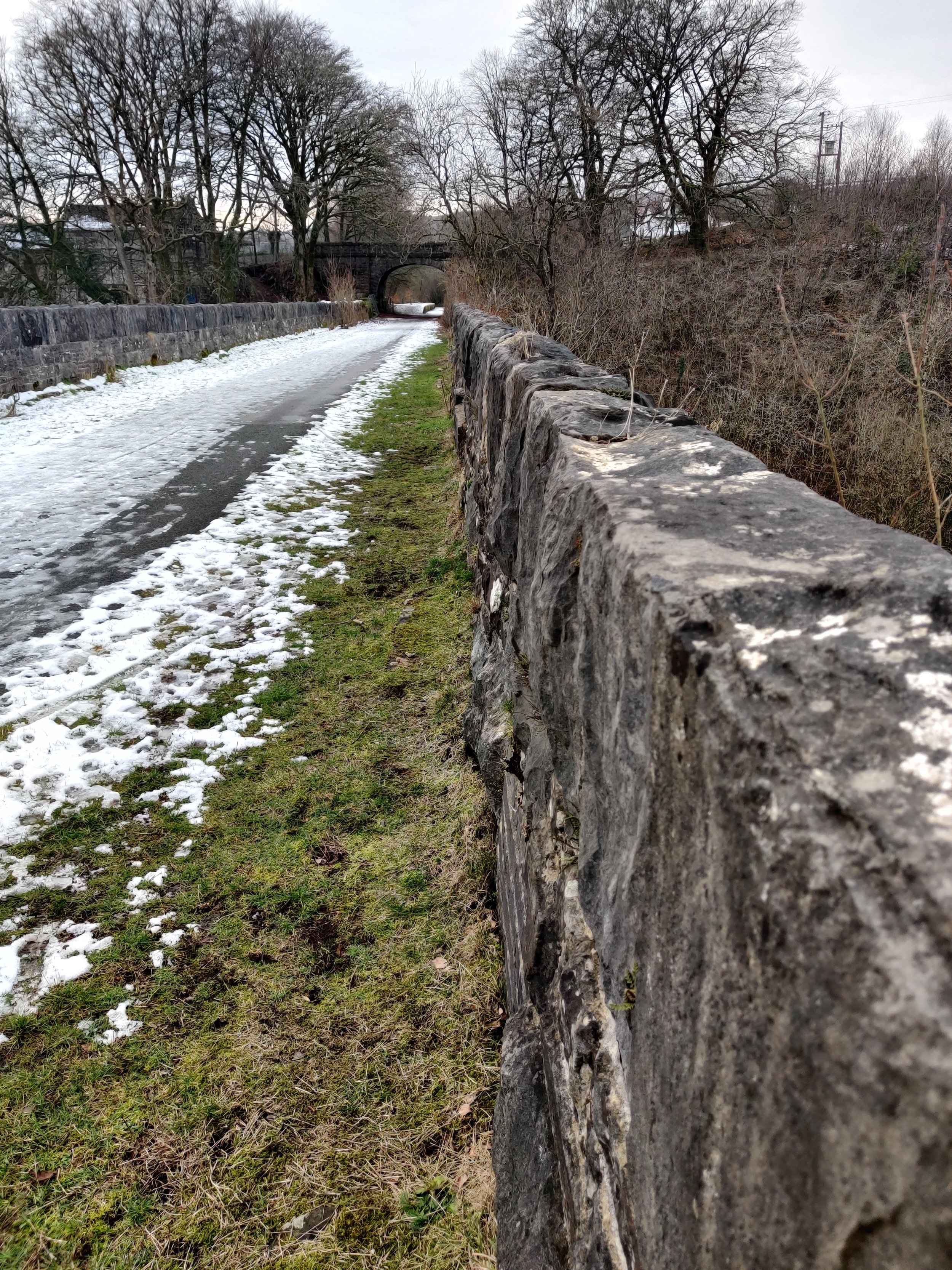
The railway closed in 1966. The track bed is now the route of part of the Taff Trail, a walking and cycling route between Cardiff and Brecon. When the railway was open, and the majority of the population worked in the iron and coal industries, the presence of Pontsarn Halt at the west end of the viaduct made this a popular destination. The rather beautiful spot was apparently known locally (with typical imagination) as “Seven Arches”. The moniker was accurate – Coflein is wrong in stating that there are eight.
The river has carved its channel through limestone (left). Just downriver it has carved a narrow gorge (right); the road crosses here by a little bridge springing off the rock.


Upstream, it is clear that the river sometimes flows with considerable force, carrying sizeable boulders with it.
The piers of the river span are founded directly on exposed rock. The west bank pier (right photo) straddles the edge of the shallow gorge where the river does a dog leg. I didn’t get a view from downriver. I wonder how much of the undercut on the east bank (left) has developed since the viaduct was built. Presumably the other piers are also founded on rock.


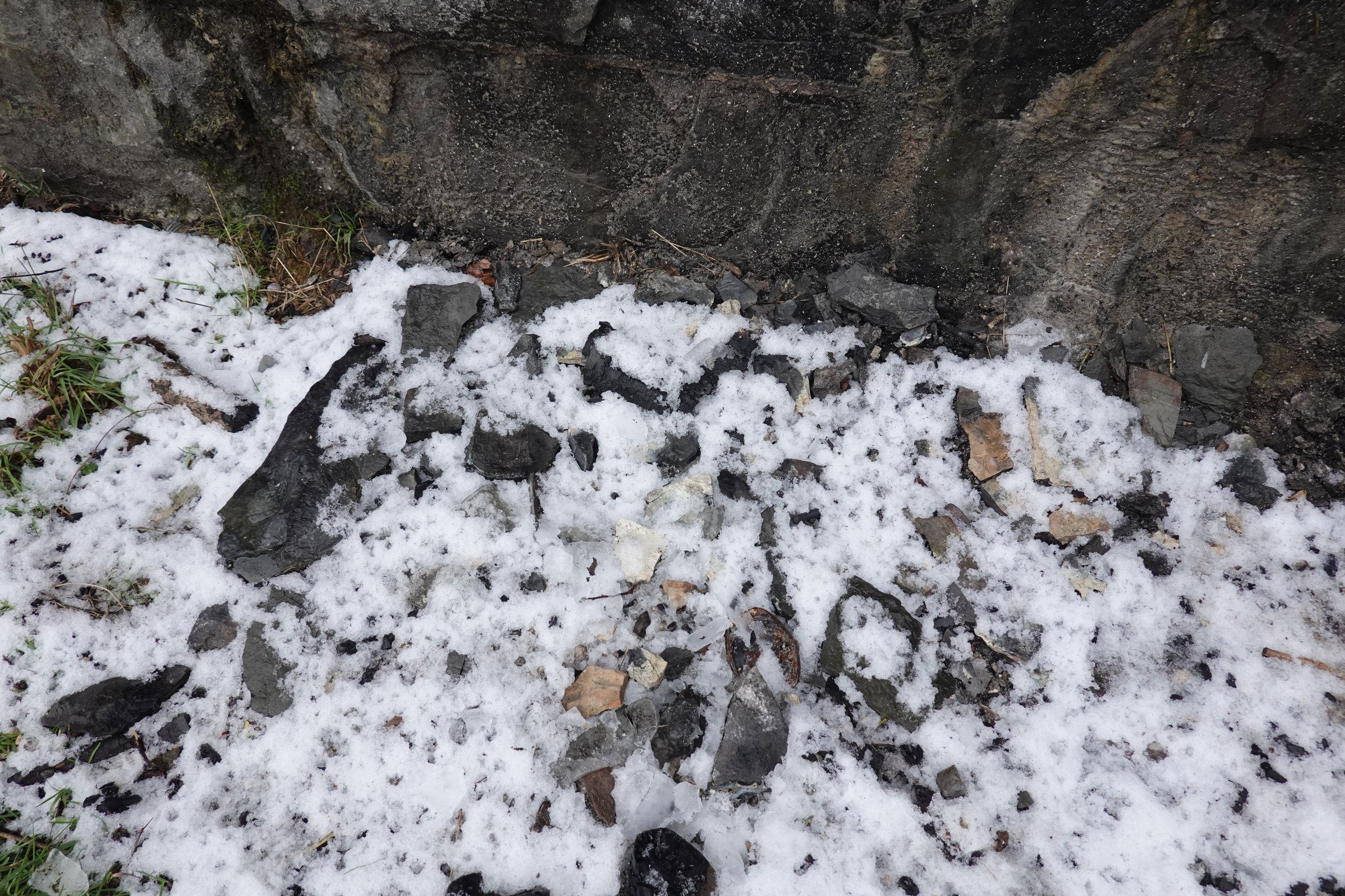
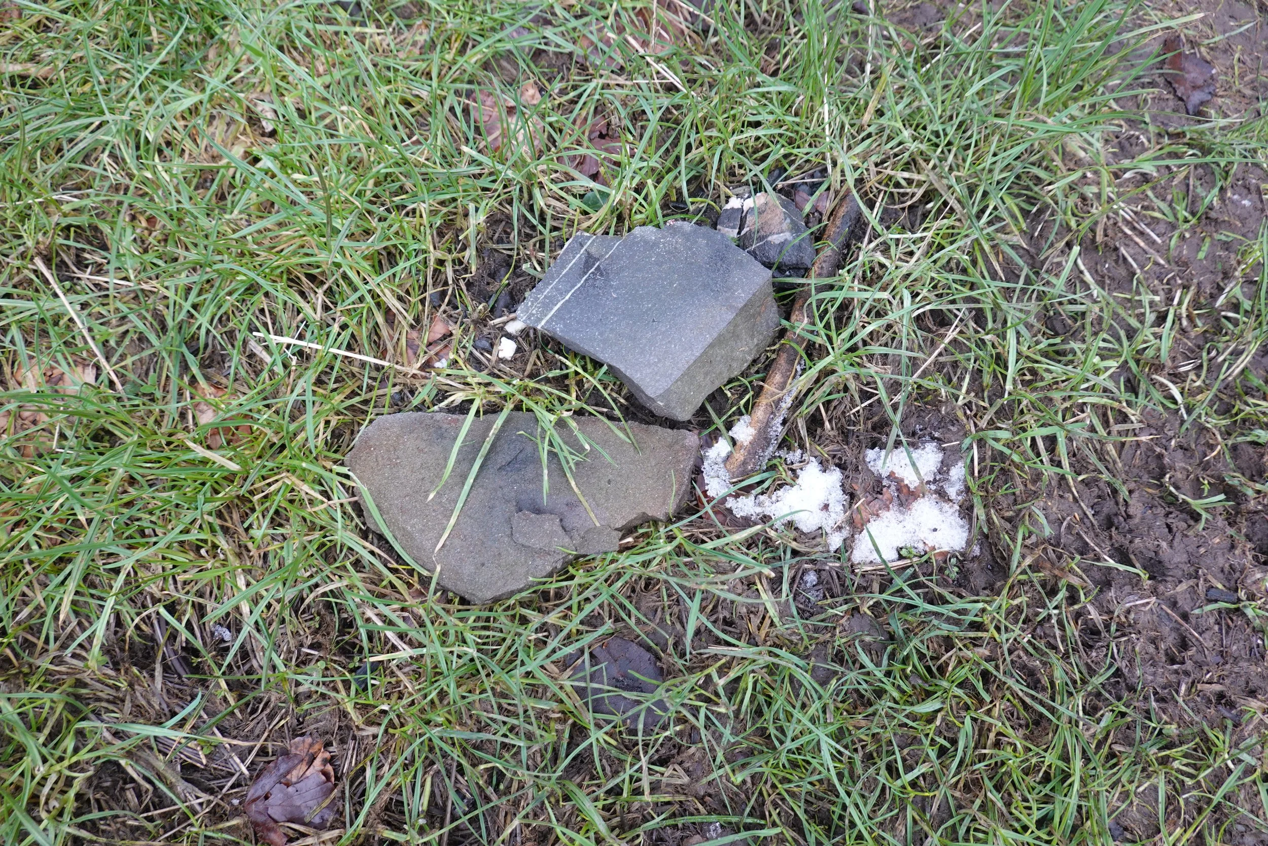
The bridge is built of local stone, reportedly direct from adjacent cutting, perhaps to the east, where the track bed runs along a ledge cut into the hillside. That stone is not the most robust; a scattering of small shards is found on the ground around the piers.
The small shards are only part of the story. It doesn’t take long to find cracks that will sooner or later lead to larger chunks dropping. From the crown, cracks at the pier corners are most visible. Trees are established in some of these, prizing them open at several levels.


Some larger pieces have fallen here and there, including these sizable chunks from the string course and parapet.
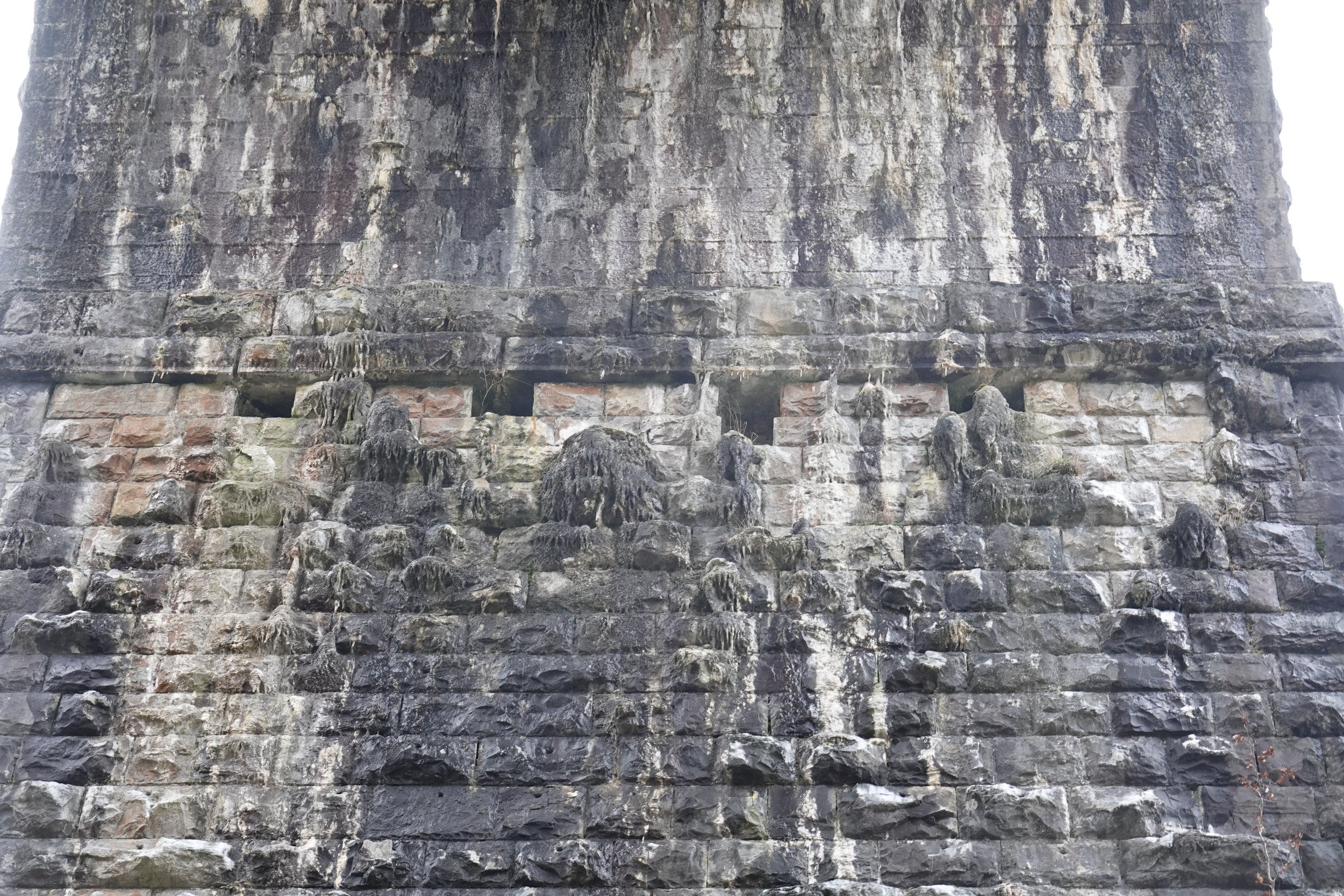
There are remarkable lime growths on the upper part of the pier in some spans. I thought these might be nests until I was able to inspect the photographs. The pier faces are battered, and the stone rusticated. The drips must have landed where the stone protruded furthest to begin with, and the lime built from there.

There is a row of four putlog holes below the impost stones. In the photo above, a stone has been lost below one of these. Given the unfortunate alignment of the perpend joints, was it simply pulled out when the centring was removed? The end holes seem to be blocked. But wait … elsewhere there are beautifully dressed corbels. It just happens that in the photo above they have snapped off.

The arch rings are in less than perfect condition. Not terrible, but lots of water flow and clear lines of weakness stepping along perpend joints.
The presence of four drains in that shot is interesting; they weren’t visible to me from the ground. The variability of placement confirms the visual impression that these are retrofitted. We’re looking at the crown here. There is a definite increase in flow through the joints to the upper and lower edges of the frame. The drains seem to have been placed rather high relative to where the main flow starts.
Making sense of the damage would really require getting a camera much closer and building a model. Bill’s Sony RX100 has a remarkable zoom range though for a carry everywhere camera. The photo below was hand-held from 25m range. Interesting that this soffit is not built of neat courses. The masons here worked just as they would build a wall, making the most of the stone that was available. Notice at the top, left of centre, a stone notched to accommodate a step in the course below.

Other spans are similar. Are the striking runs of joints just highlighted by water flow, or is there some movement involved? The viaduct was built for twin track but only the north side track was installed. I would have to visit again to see if there is any indication of a link to loading. The line was built for mineral traffic, but was out of use long before the long wheelbase wagons were introduced that have caused so much damage to viaducts. The suboptimal position of the drain is clearer here.


How was the drainage supposed to work? This is an interesting feature. The drainage comes from the pier centres, as is common, suggesting backing sloping down a low point. The position of the drain is very low, so either draining the bottom of a deep internal sump, or there may be internal walls, with drainage from the base of these rather than the top. Whatever happens internally, the flow is caught directed by hoppers into short stubs of drainpipe, then discharged with a half-hearted attempt to get it clear of the masonry.
I didn’t realise until looking at the photos that these rainwater goods are mounted on timber packers, accommodating the rough surface. There appears to be a stray piece of timber stuck behind the hopper above, and the base is on four packers. I fancy these aren’t original; I wonder what preceded them if that’s right. How long have the timbers been there? And if the pipes aren’t original, is the drain? I haven’t seen remains of any other drainage.
Drainage is provided over the abutment, not universal, but probably wise given the scale of the abutment here. Another curiosity in this view: there are no putlog holes at the abutment.

Moving up to the top, after a short break in the pleasant and popular Aberglais Inn, we can see the width, good for two tracks. The scale of the tree growth down the insides of the parapet is quite shocking, given the accessibility.


It is good to see something, albeit brief, made of the engineering heritage. More of this please.
Less positive, the feeling of decline felt from below is borne out with evidence of real damage resulting from neglect.


A close look gives a nice view of typical wall construction, with two faces and a core of shards, mortar, and considerable empty space. No match for the relentless power of unchecked tree root growth.

A look past the end of the parapet highlights the scale of the valley.
Earlier, rather functional repairs suggest that the parapets were never the most robust, or the best maintained. There are many patches, some in stone, most in blue brick, several proud of the original surface.


A camera held over the side captures some of the drama of the location, but also happens upon a fractured stone in the string course, waiting to go the same way as that featured earlier.
A pronounced outward tilt in the north parapet increases to a point. I confess I didn’t check how this aligned with pier or span below. L'esprit de l'escalier.
A path (perhaps unofficial) down the valley side to the south east offers a fine overview.

A slightly zoomed view nicely captures the over line bridge to the west, and shows the slope, not previously so obvious. The stone courses are independent over each pier, and meet in a jumble over the crowns. Note again how low over the pier the drain hoppers sit.

A stitch in time saves nine, the saying goes, and nowhere is this more true than in managing vegetation on structures. There is real, difficult work to be done here, and it is becoming increasingly urgent.