A PDF version is available here.
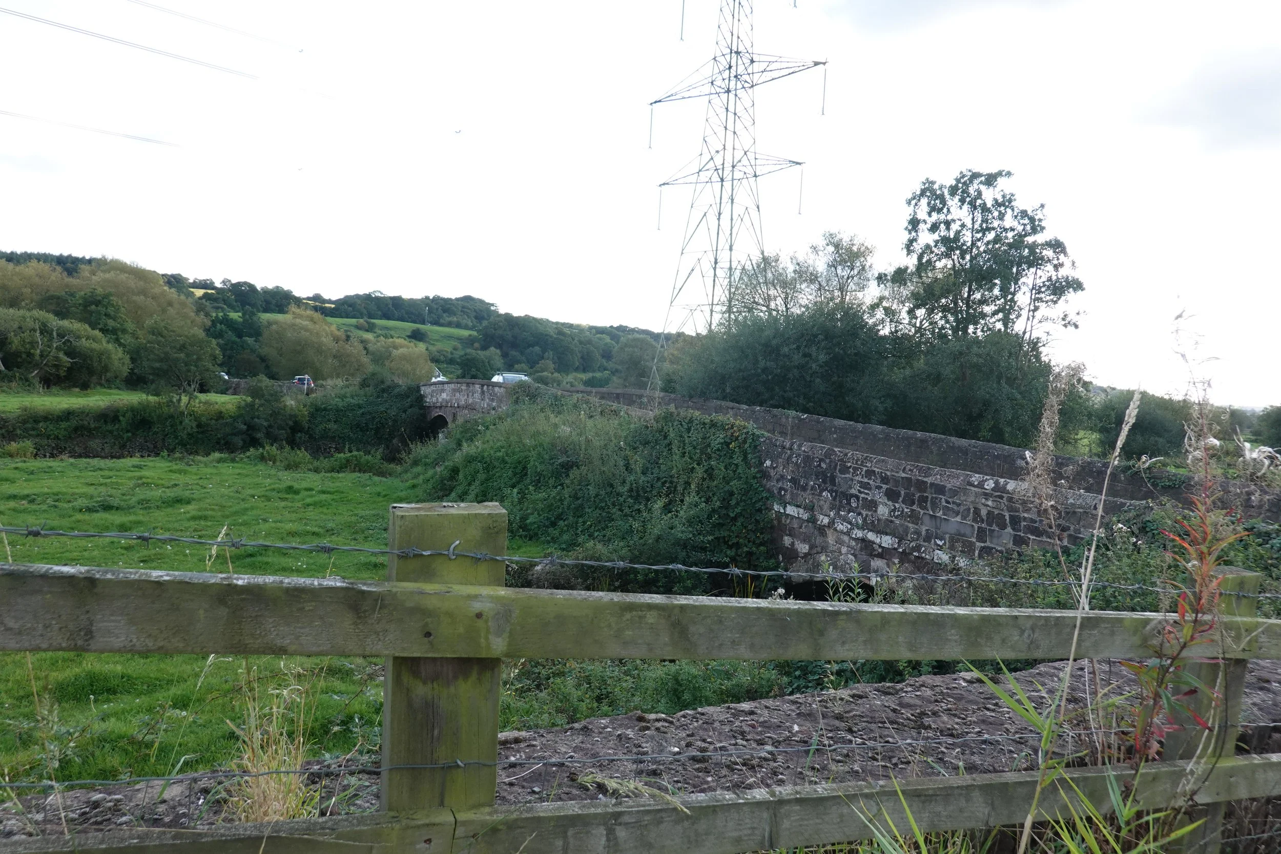
Stoke Canon is a village a couple of miles north of Exeter. It is between the river Culm, close against the east side of the valley and the Exe similarly close against the west. Across the Culm flood plain is another mediaeval causeway that I have only just got round to looking at. These pictures show the western end close to the village and the eastern end against the steep valley side.

Here is a view from the east/south with the causeway stretching beyond the trees with a car just appearing.
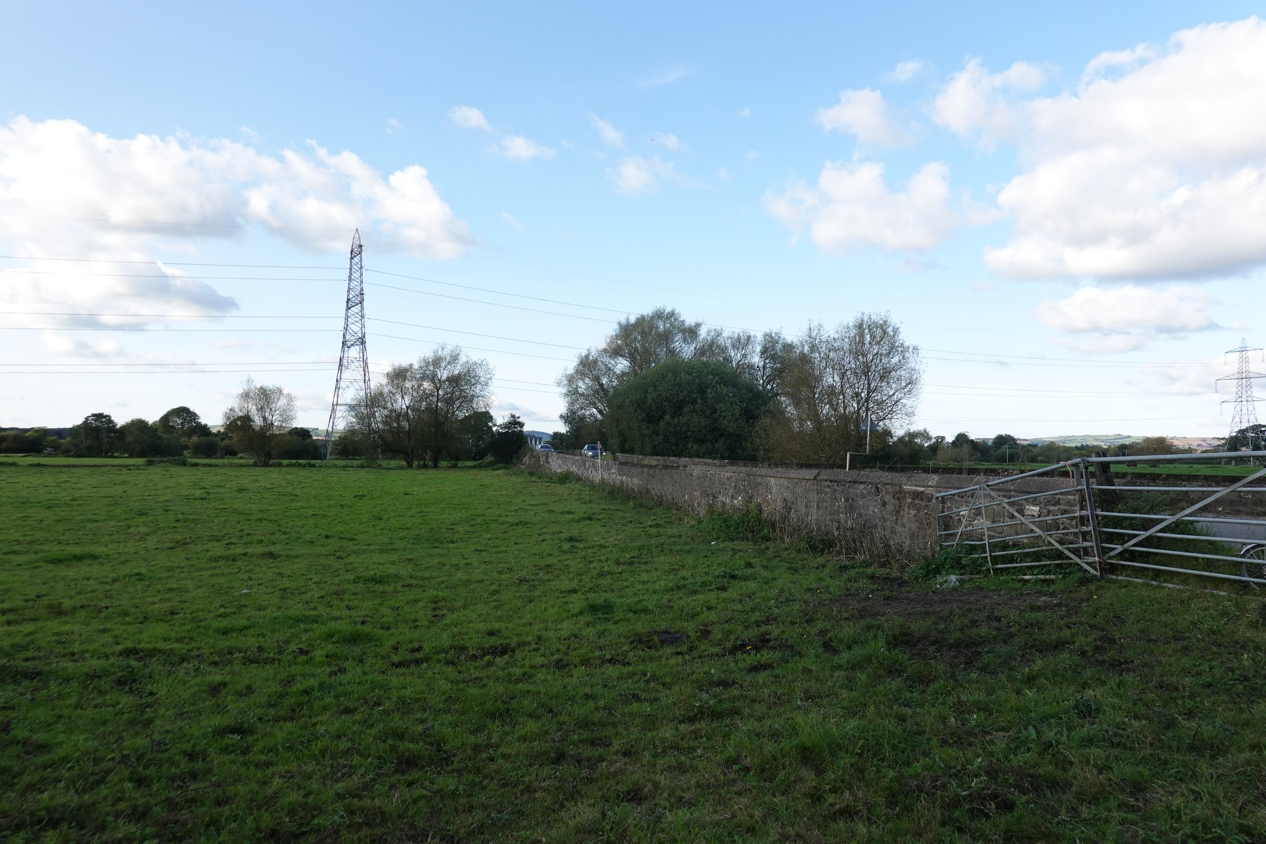
From the west/north end the trees are still some distance away.

At the west end is a flood span that looks remarkably flat, but is obviously mediaeval.
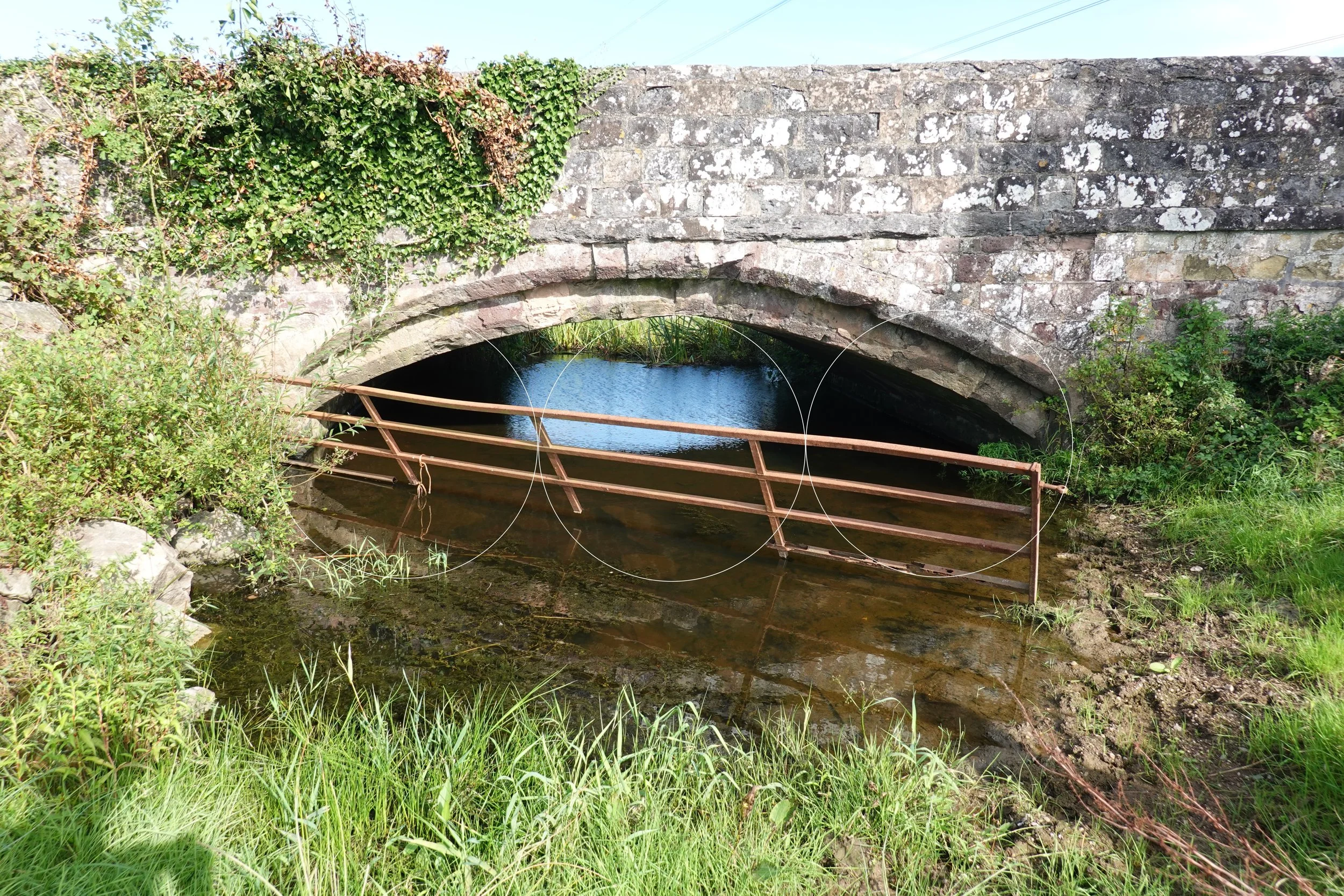
Overlaid with circles along the springing line we find a span rise ratio of 6. Really unusual.

There is an arch, slightly narrower than the original bridge with a corbelling archivolt above. Notice how the chamfer runs put at the springing line. The historians and archaeologists with whom I first visited had never seen such a detail.

Looking underneath, and with the benefit of a reflection, the bridge may be old but is still in excellent condition.

From a slightly different angle, you can see where the old bridge ends and the widening begins. Unusually the widening is all on one side but we will see why later.

A little to the east is the river Culm proper, with a 3 span bridge widened a little on the near side.

From a little closer we can see through and find there is a widening on both sides sitting on the original cutwaters. Solid foundations then!

Judging from the different stone, it is possible the abutment had to be widened to take the new arch.

I wonder whether the spandrels really needed tying together.

Back to the west end and I got the camera low enough to see the soffit properly. The masonry is in much worse condition where it is regularly wet and dry.

The end decoration here is clearer to see but is actually redone in mortar.

Looking through we get a view of the widening, which matches the original for curve much better than would be normal. Either the stones were driven in hard or the centre was set slightly high.

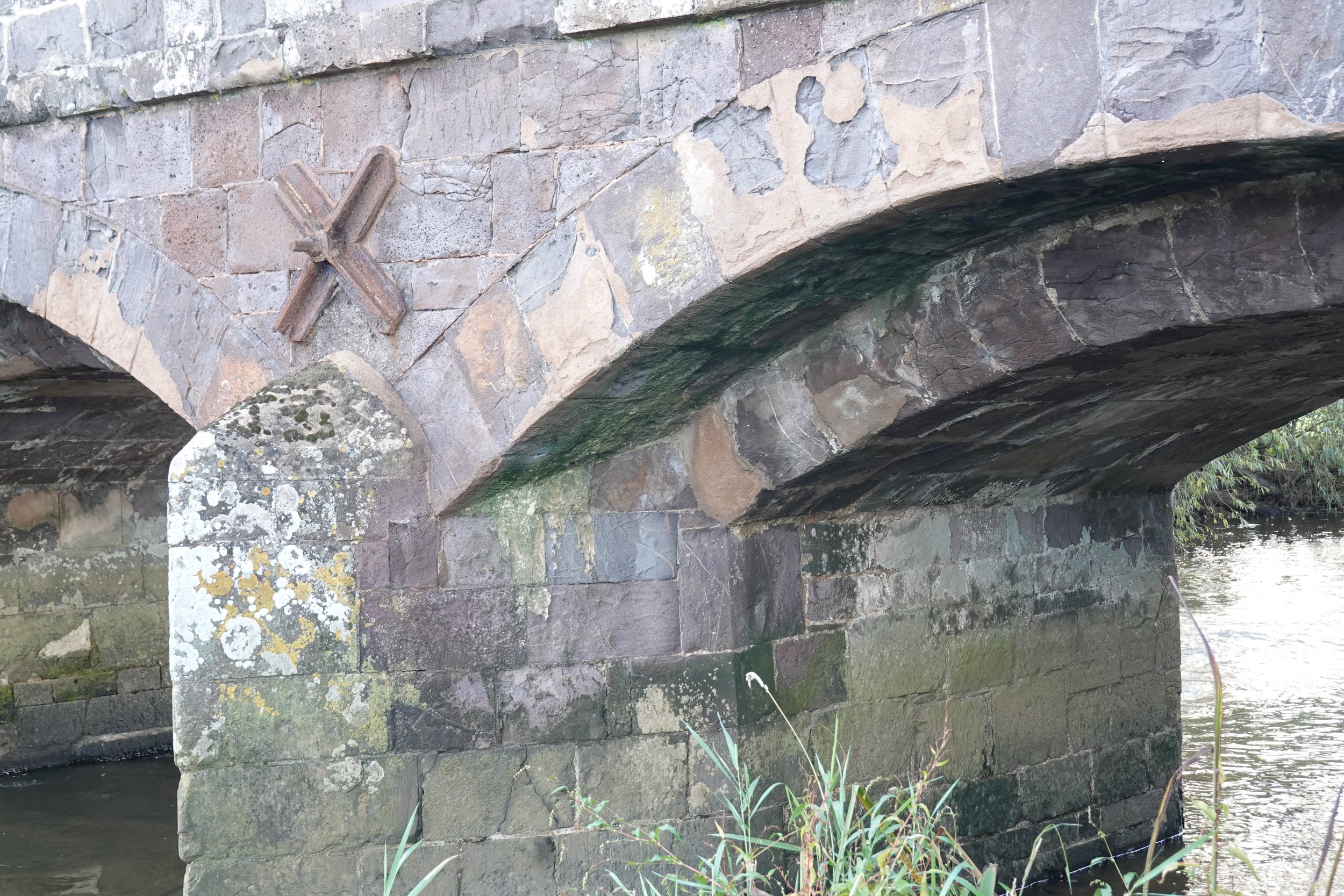
The best available view of the east end decoration.

This stone has a complex story to tell. Different material, badly eroded but proud of the rest of the arch. Has it swollen or was it a later insert that was placed without care to dress it back. Perhaps the mason knew it wouldn’t take kindly to the run-off from the surrounding volcanic material.

Here is the river bridge from the north east. Even on the multi spans, the arches are flat.

A definite sag in the string course, so these widenings dropped when the centring came out.
Constant curve and gradually increasing span means the springing point drops across the width of the widening.

This is the flood arch at the west end again. Can’t get close but can get a reflected view of the soffit. The broken-out stone near the crown means that the new (near) arch is flexing very slightly more under traffic. Of course the old bridge is also stiffened by the now buried spandrel wall.
The apparent cracks at the far side are shadows of the gate reflected on to the soffit.

Nearer the middle of the length is another flood arch. As flat as the rest.

As at Clyst St Mary, the walls are tilting somewhat. Because this road is well trafficked, buttresses have been added.

Further east again there seem to be two spans with a small branch of the Culm running below.


And at the very east end is a smaller span that appears to be skew. I couldn’t get closer to get a better picture.
There it is then, eleven years of BoM and not one missed. Quite a proud achievement. I still have a book to finish and now I can concentrate on that for the 2.5 months left of 2021. Talk to you all again in the new year. I wonder what that will hold for us all?