

This long causeway across the Clyst flood plain looks sadly neglected in the photo. It is actually little used since the new road (visible in the distance) was built in the ‘60s, though it remains popular with cyclists avoiding the traffic. I have lived in Exeter for 26 years and only recently got down here with a camera. The bike in the picture is mine and my sunny October Sunday took me here and to Stoke Canon to the north, which will feature in December to complete year eleven of BoM.
I think that we can assume the date has some basis.


The main course of the Clyst is at the city end (west) where the “new” bridge is undergoing substantial repairs. Note how the new actually cuts across the old. I suspect the causeway continues for some distance under that embankment.
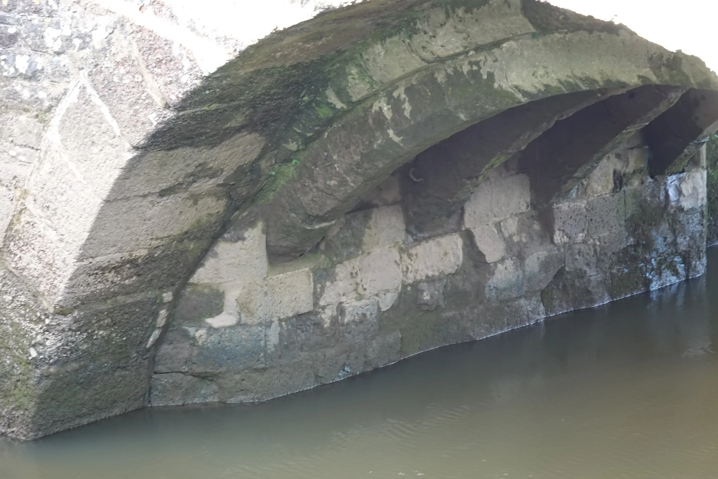
Looking closer, the camera manages to see into the shadows and reveal the mediaeval origins, obviously rather narrower. Those ribs form a relatively flat arch for their time.

Interesting that there is no cutwater left even on the upstream side.
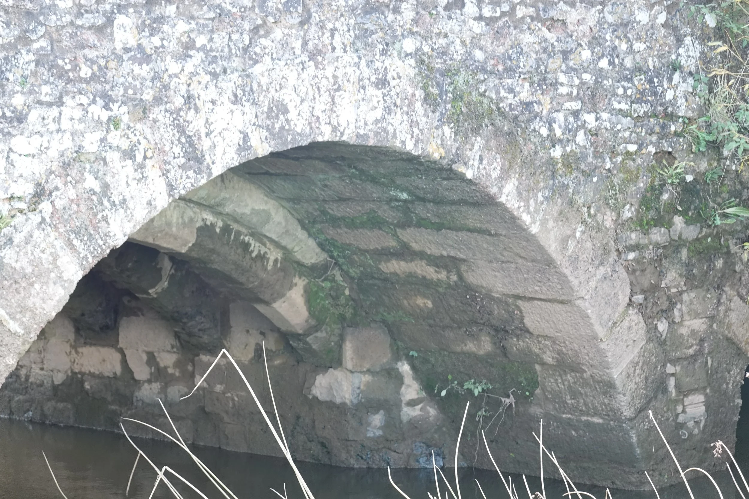
The widening this side is slightly greater. The new arch continues way beyond the springing of the old creating a much lower and narrower pier.

There is just one flood arch about mid length, so when the river floods this must present quite a barrier.

The wall of the causeway tilts at quite an angle but then, its foundations are probably both shallow and soft.

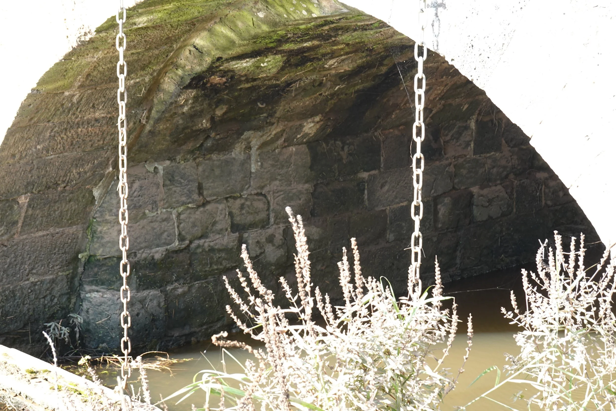
The flood arch also has a mediaeval middle section, though I couldn’t get closer to see it properly.

There is a much less active secondary channel with another two arches at the eastern end.
No ribs in these arches. Are they later?

Once again, the widening arch continues beyond and below the originals.

And to finish, here is the out-of-town end continuing into the village of Clyst St Mary. The environment agency have built a very substantial flood wall up to the top of the parapets. Have they just assumed that the parapets would take the load? I very much doubt that they would. In any case, what about these drains?
