
A PDF version is available here.
I’ve crossed Old Leckwith Bridge (map) a few times over the years on my way to Leckwith Concrete Products for supplies of CT1 Grab and Bond adhesive, ideal for installing our Moiré Tell-Tales.

Grade II* listed and a scheduled ancient monument, it is suffering from sustained neglect. Perhaps the situation will improve if a planned development goes ahead (planning application). At least that will remove the cumulative damage from careless driving, though it doesn’t guarantee any more attention to ongoing maintenance.
There is a Coflein entry for the old bridge, and listing data. Wales Online wrote recently about the history. A blog post at “Hidden Glamorgan” has a little about it.
The listing states, “Medieval in origin, possibly partly reconstructed in the C17, with the central arch probably rebuilt in the C18. The bridge was by-passed in 1934. Leland recorded Leckwith Bridge as being 'soundly built of stone' in 1536. Rubblestone bridge of three arches, the two outer ones pointed with double arch rings, the centre one semi-circular and probably rebuilt. Carriageway about 2.75m wide but with refuges above pointed cutwaters. The two elevations are the same. Low parapet walls topped by flat slabs. Included and highly graded as a fine and rare medieval bridge.”
The two elevations are not the same! We’ll come back to that.
The old bridge has three spans, separated by piers with cutwaters and refuges up- and downriver.
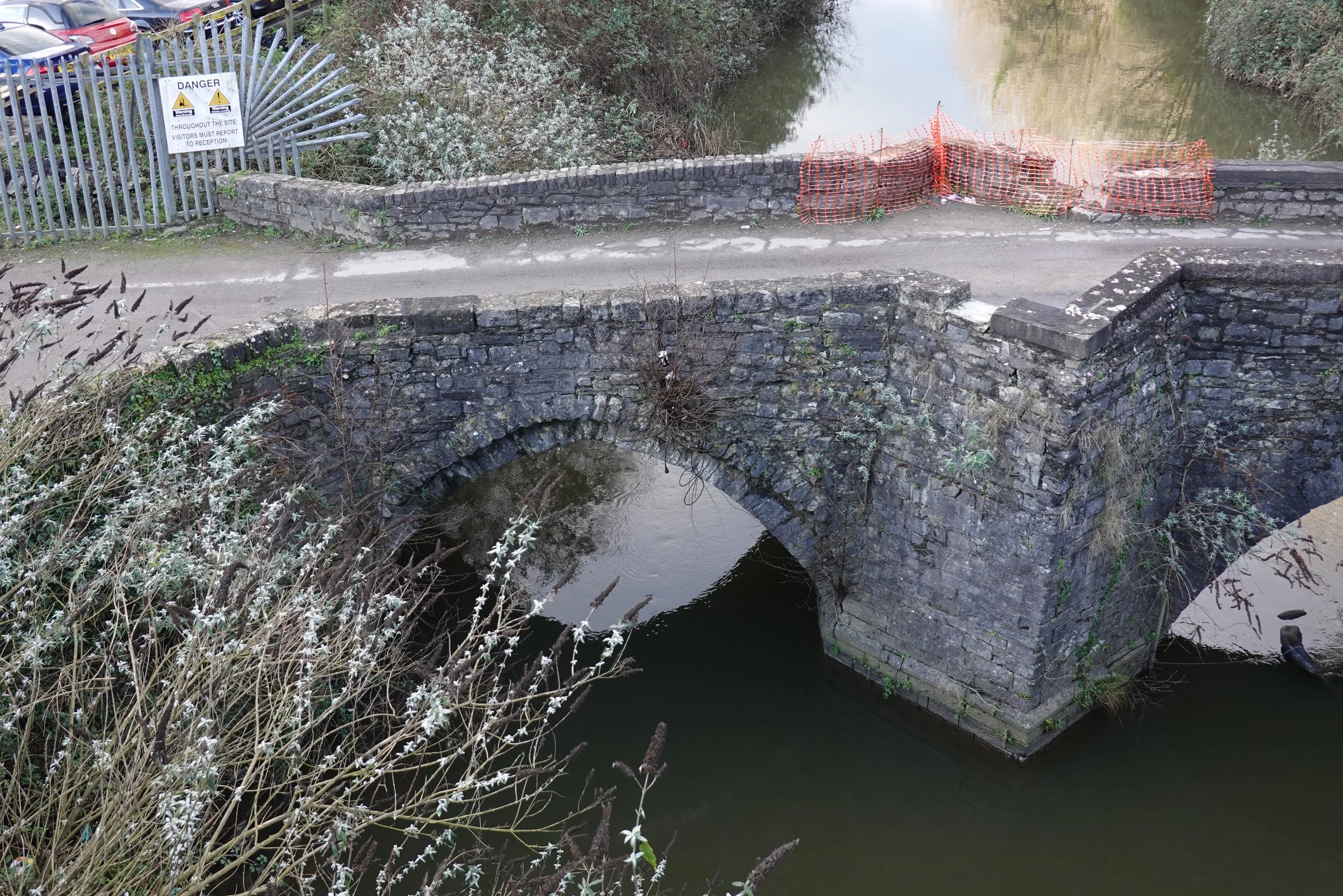

The end spans are each pointed with – on the southeast elevation – two expressed rings of stone, though the geometry of the two feels different, the point of the east span being more pronounced. The upper ring corbels out over the lower in both cases.
The central span, visible in the first photo above, has a single expressed ring and a circular curve, high but well short of the semi-circle. It seems likely that this middle span and at least one of the others have been rebuilt.

A significant amount of parapet masonry has been lost. Mercifully the damage has not yet extended below road level. The gap in the parapet left is from vehicle impact and will have been lost into the river Ely. (It isn’t clear what the mesh netting is supposed to achieve.) Long runs of missing coping stones seem at least as likely to have been deliberately cowped into the river or stolen. Vandalism and theft are both much more likely when a bridge is obviously neglected.
There is a high probability of more extensive and more serious loss of material. Some of the cutwaters show characteristic damage from vehicle impact: a diagonal crack tapering down to the nose (below left, right). This issue plagues Bidford Bridge – CCTV footage. Once the fracture exists, the force needed to finish the job is much reduced.


The coping stones don’t seem to fit everywhere. They look rather different than the rest of the masonry too, so probably a later addition.
Evidence here too of the buddleia being cut back – but this is superficial treatment, as it doesn’t stop regrowth, and the roots continue their attack on the fabric.

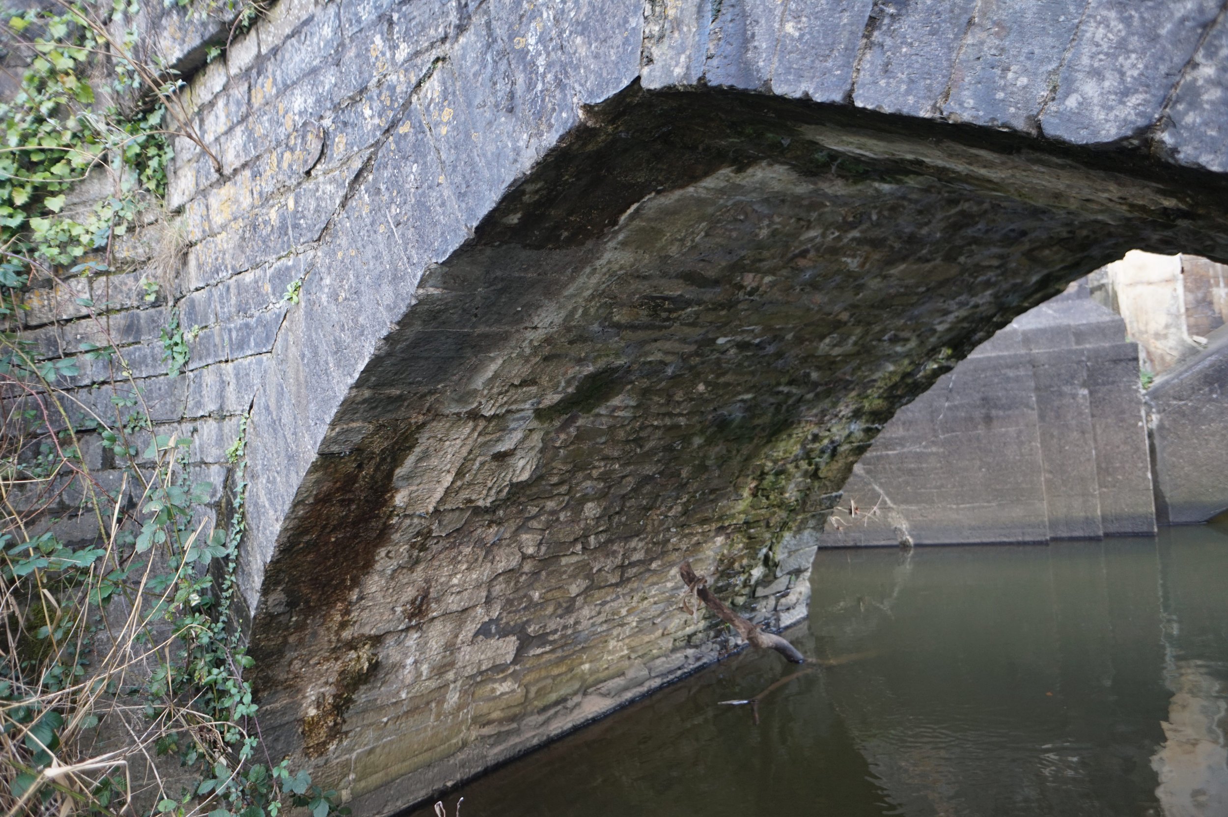
I took some photos with a pole camera to get a glimpse of the soffits. A photogrammetric model would make interpretation much simpler, of course. This one shows a fracture inside the spandrel wall, which was obviously large once, then filled with (cement) mortar, and has now reopened. I’d guess the “repair” was decades ago, and the crack width isn’t huge now, so the movement is slow, but it hasn’t stopped.

The lowest course to the water above looks like dressed blocks in contrast to the rubble above.
This shot (right) captured an outward displacement of the parapet over the central span on the downriver (southwest) elevation. This has developed since the bridge was pointed, again probably a few decades.
It turns out that the upriver (northwest) elevation is different. This is the northeast span. While most of the width is rubble, this edge of the ring and the spandrel wall are of ashlar. A repair, or a widening?

Same span, looking to the other springing, I’d say there was a diagonal fracture in the cutwater running down to just above the lower step.

The middle span (left) again has neatly dressed voussoirs. The parapet, which is riding out, looks to be of rougher stone.
The southwest span (below left and right) has a corbelled ring on both elevations, but the upriver elevation (below left) still looks a bit different, with thinner (or longer) and better dressed stones.


Looking along Old Leckwith Bridge from the north-east we see substantial bollards, an inadequate attempt to protect the bridge from traffic. Also visible is the 1930s bridge to the left (south). In the distance, the old farmhouse is visible among more modern buildings. The nearer gable in the late 1800s photo below (People’s Collection) has been demolished. The one visible arch of the bridge looks much as it is today, though the slope seems more pronounced.

The planned development involves replacing the 1930s bridge to the south with a precast RC beam structure to the north (see “Technical Report (bridge)” in the planning documents). It is claimed that the planned new road bridge into the development will dominate the medieval bridge less than the current 1930s RC arch.

The proposed bridge has (and pretends to) no architectural merit, it is a purely functional design, whereas the 1930s RC arch made some effort in design and detailing. It is more open. The arched form is attractive in its own right and more in keeping with the masonry bridge. It is also further away and higher than that planned. The height is significant, as it allows views between Old Leckwith Bridge and the river in both directions.

Unfortunately the 1930s bridge isn’t in great condition, and its position doesn’t suit the development at all. The plan therefore is to demolish it, and build a new one for motor traffic on the other side of the masonry bridge. The masonry bridge will remain open to pedestrians and cyclists only.
There are clearly many constraints that the new bridge had to meet. It would seem that if the aesthetics of the new bridge itself or its impact on the setting of the scheduled monument next door were seriously considered in the design process, other considerations took precedence. That may be reasonable, I’m not in a position to judge, but if so it would be better to set out those trade-offs and make the case than to claim that the new bridge will dominate Old Leckwith Bridge less than the 1930s bridge. That claim is far-fetched, and it is disappointing that CADW seem to have made no comment on this.
All in all, this is a lovely and significant bridge in very poor condition. Getting the heavy traffic off it will reduce the threat of major damage. I trust it will be fully and sympathetically repaired as part of the development, and hope that its new role in the landscape will result in greater care being taken of it in future.