
A PDF version is available here.
Here is another bridge on the Highways England hit list. It is in Allendale, close to Haltwhistle, to the west of Newcastle. Here is an elevation. It is taken from a model which you can view here. The photos were taken by the HRE Group, the model built by us.
The photographer had written guidance but no training. The result is remarkable, but not perfect, and we must interpret with care. We start with a quick check over the model, something which engineers should always do with surveys of any kind, even ours!
The white patches are where photographic cover is limited in some way. This results in large triangles in the model, which we filter out when we produce models, as it is better to have holes than the false appearance of completeness.
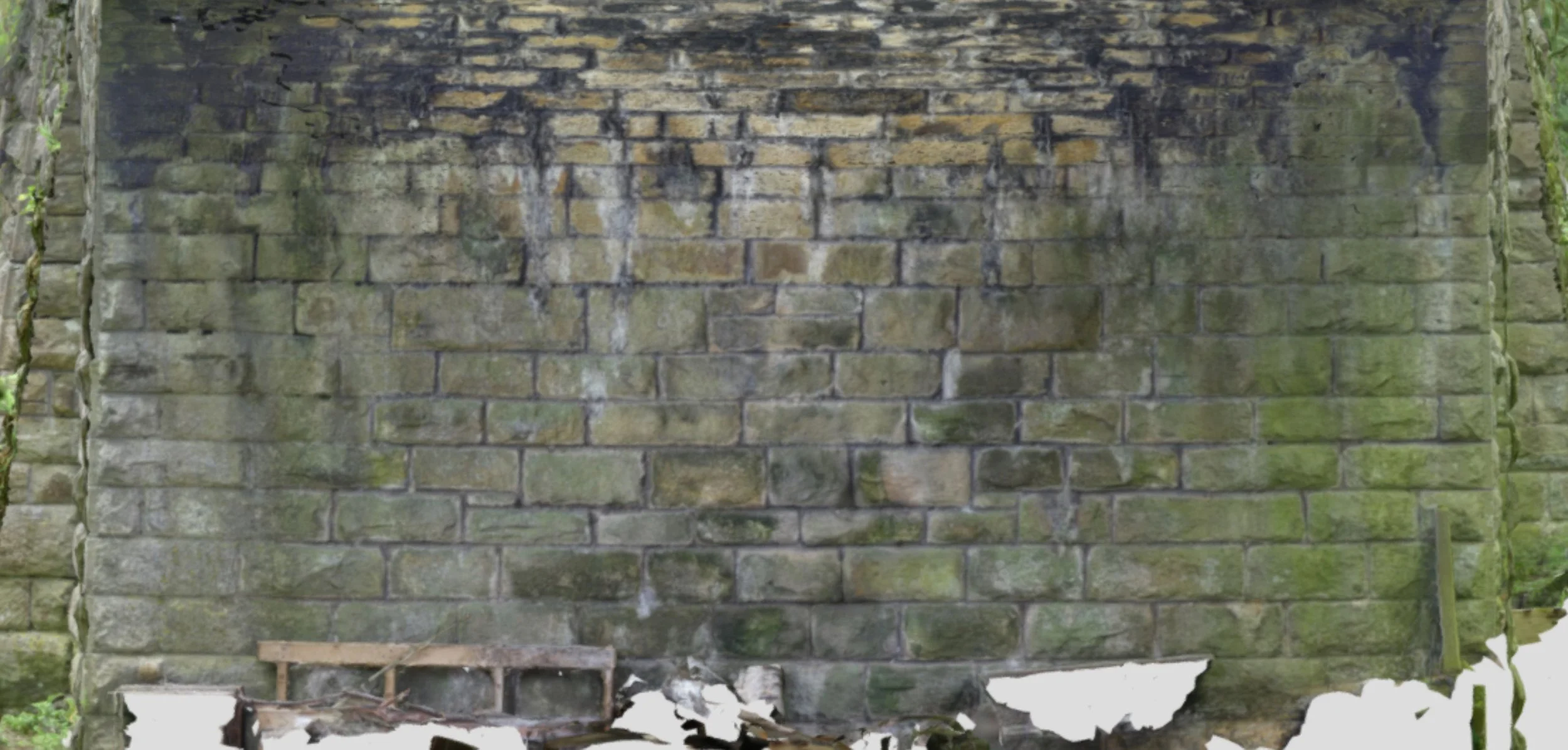
We can see that there is something strange going on in the parapet top left of the span and a closer look at that will inform us of the sort of errors that can develop in these models.

The string course is straight and the parapet has a step. The difference develops over a sloping line. This happens where there are photographs from two different directions that are only indirectly linked. Cumulative errors result in an offset between parts of the model coming from the two sets of photographs. The lower detail and quality to the left of the line suggests that this area is coming from more distant photographs.

Here, the combination of moving and turning the camera resulted in limited overlap between photographs. The aim is generally for 2/3-3/4 overlap in both directions. This can be difficult to achieve at close range when working with a single camera, which is one reason that we use rigs carrying multiple cameras for our commercial modelling work.

Above the abutment at the left of the main elevation, there is a further step in the parapet which just might be real but it seems unlikely. In the wing wall below there are some wide empty joints and some modest vegetation.

If we zoom in a little and look at just the ring, there are a number of interesting details. First, note that the voussoirs are of apparently random thickness. The joints vary in thickness too both from joint to joint and through the depth of a joint. Most of the voussoirs seem sensibly wedged but one or two near the crown look parallel-sided.

Looking closer at the soffit, the interesting features are in the corners. Here we have some completely empty perpend joints, though the bed joints are largely full.

Move to the left and there is no apparent deterioration in the corner.

At the other end of the span there are some empty bed joints. A closer look shows stone that has been washed away from the edge of the joints. There has been a lot of water through here down the years.

There is a further line of water run closer to the springing. I presume this is coming down the inside face of the spandrel wall to get to here.


The fourth corner shows lime runs but little more.
This abutment looks to have a substantial sag but it seems likely it is an aberration in the model. I would want to look more closely on site before drawing firm conclusions. In all other senses this looks to be in perfect condition.
The other abutment is partly obscured by vegetation and a stack of materials. Again, though, there is nothing to see that would encourage me to worry about it.
While the bridge in Devizes, discussed last month, had damage that might cause trouble but for which an infill would be of no value, here we have a structure in good overall condition. A little judicious pointing of the soffit and perhaps some drilled drains to channel the water where we really want it, would give us a bridge with decades of life. It would also avoid damaging a wildlife route and a garden.
