
A PDF version is available here.
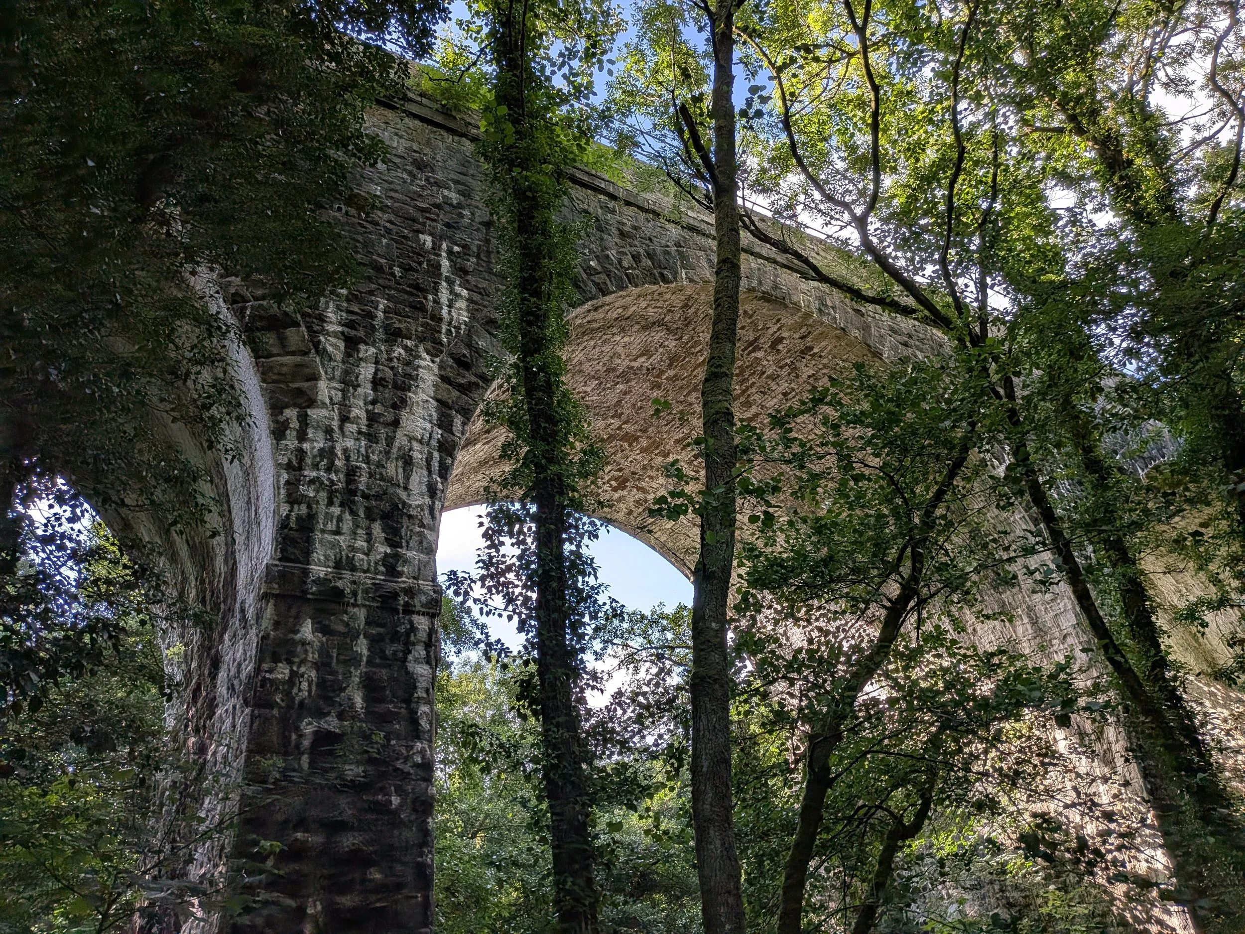
We spent a weekend in Exeter recently, catching up with friends who we don’t see often enough now Bill isn’t there. A lovely walk from Oakhampton Station brought us down past Fatherford Viaduct (Google maps). As is typical for the verdant southwest, there are few clear views through the trees.
The plaque has this as DAC 196.45: DAC for Devon and Cornwall, the number is miles and chains from Waterloo, as DAC was built as part of the London & South Western Railway. This is of course the Dartmoor Line, which reopened as far as Oakhampton in 2021.
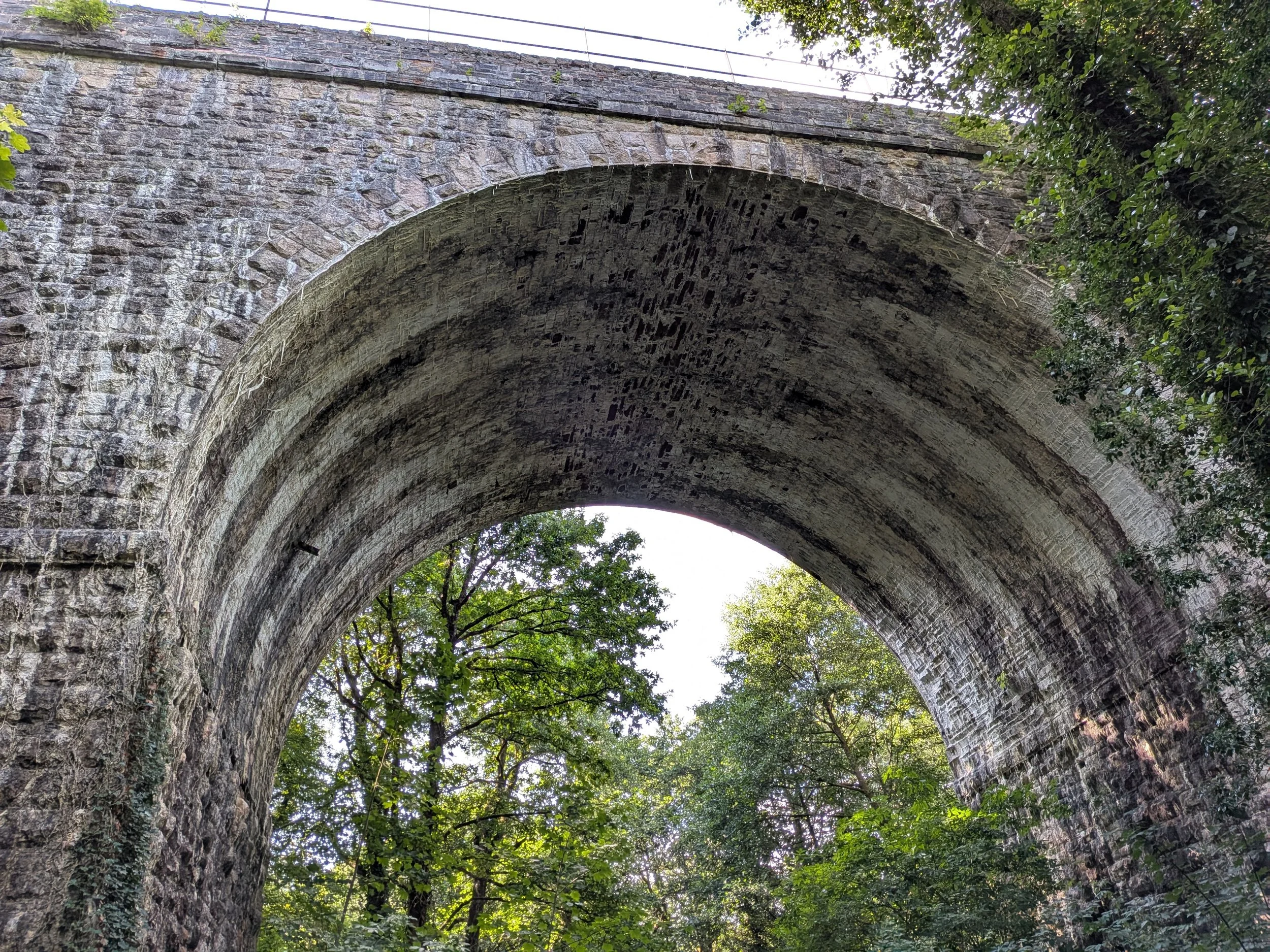
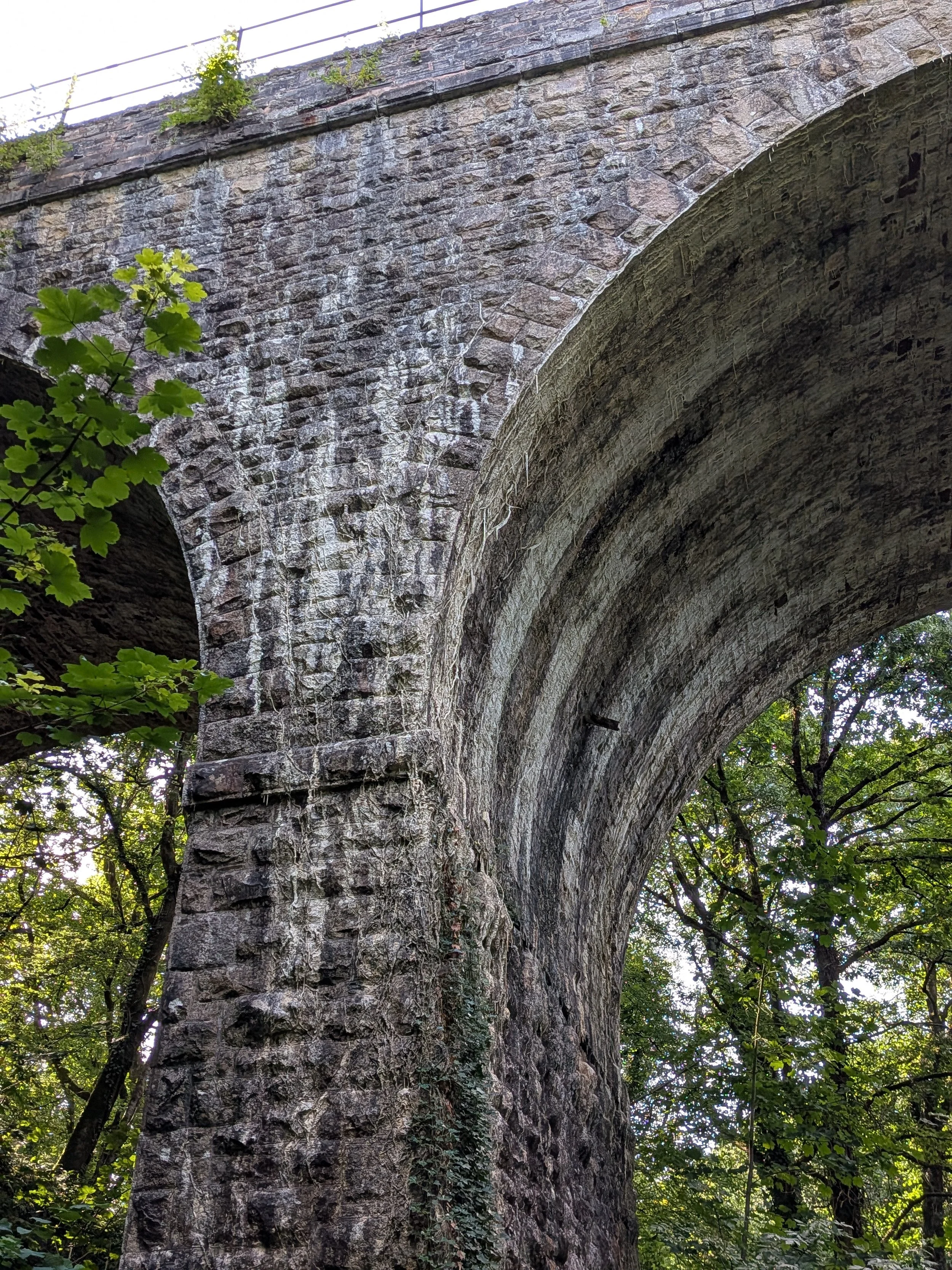
The construction looks fairly standard. All stone, semicircular arches, large voussoirs at the edges of the arch barrel, alternating between single full depth stones and pairs, with the position of the joint varying. The stone between these edge voussoirs is smaller. Basically rubble, but of a naturally slabby stone. That may mean that the bed joints round the ring open to the extrados (top), where they would need to be wedged into position with smaller stones and the voids filled with mortar. The piers are thick enough that the expressed rings don’t quite meet.
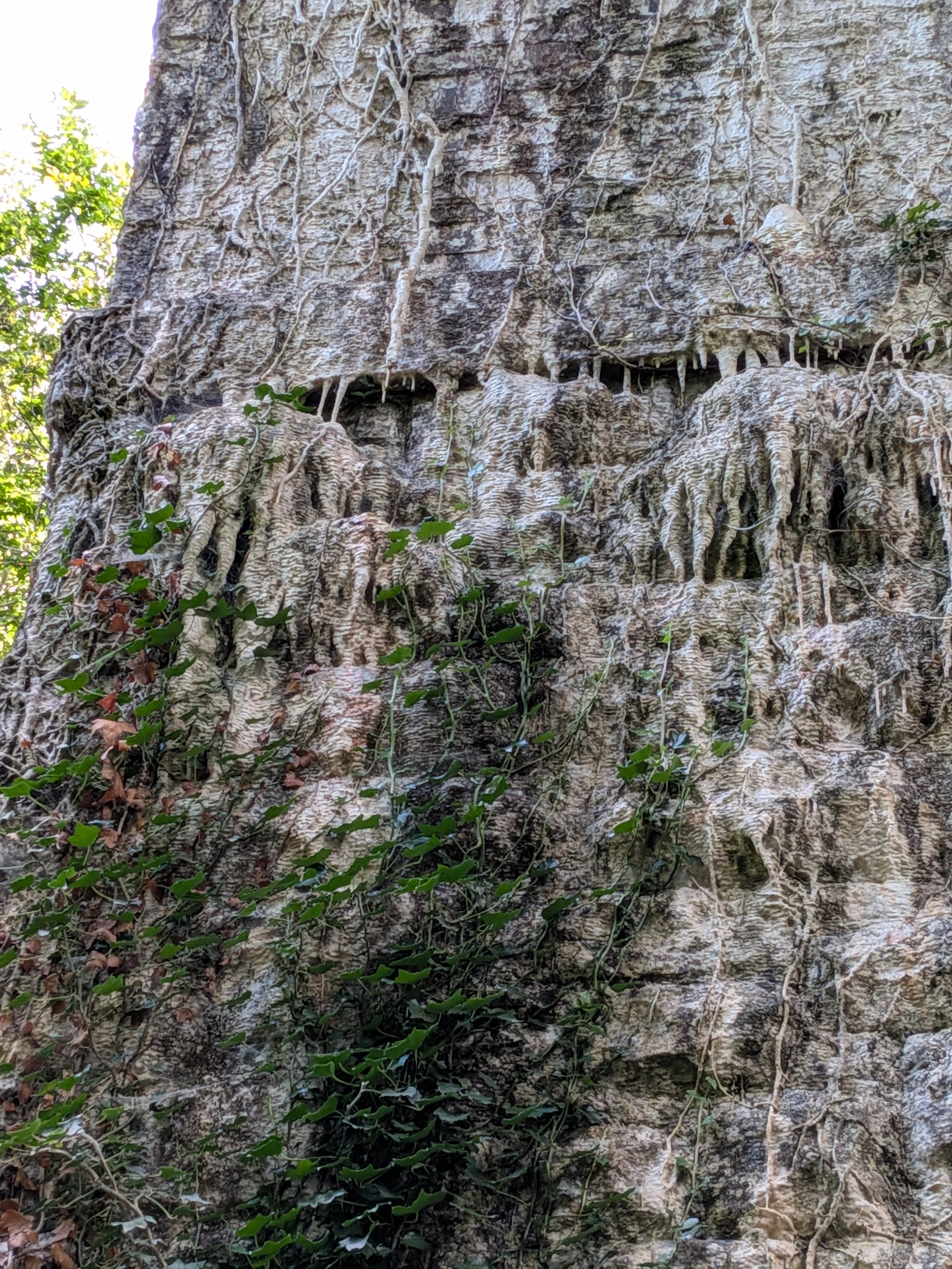
The most striking thing about this structure is how thickly encrusted with carbonate deposits it is. These have layered over and through ivy growth to remarkable effect (right).
Here and there, where the coating is less total, we can see putlog holes where the centring was supported by “putting logs” through the pier to support centring each side (below).
In training courses, I spend some time talking about external evidence for hidden details. Masonry bridges are, at the end of the day, one big hidden detail; all we have direct access to is the surface of a structure with a great deal of volume. One way or another, water provides most of that evidence, whether as visible water flows, as secondary effects of those flows as in the carbonate deposits here, or in original water management features.
Above, you can see a drain emerging radially from the arch ring at mid width. As long as we’re confident these are original – and there is no reason to think otherwise here – we can trace these up to the centre of the pier to find the point that the designer intended water to collect. Usually that would be in a sump below the top of solid masonry backing. The top of backing and the arch extrados above it would then be coated with some form of waterproofing: puddle clay, pitch, occasionally tiles.
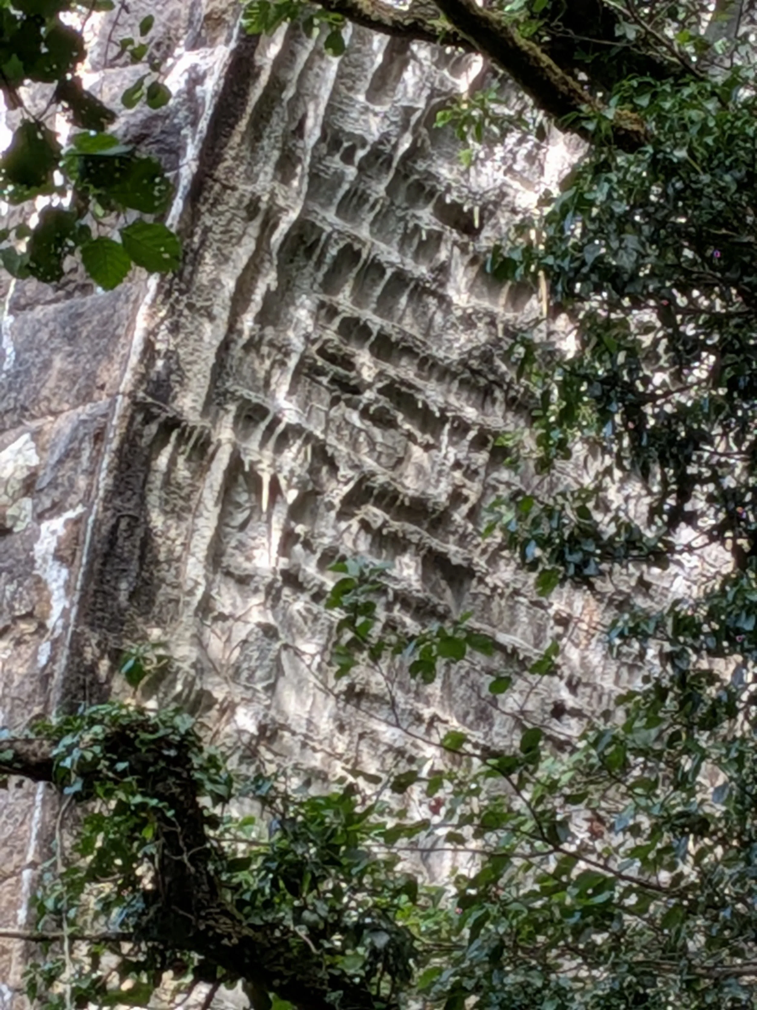
Waterproofing is never perfect, and over 150 years, water is likely to find routes through it. We often see water or lime staining starting at well defined levels, which gives evidence that water is ponding there and finding a way through the masonry. There is some evidence of that in the pier faces. The line isn’t perfectly well defined, but it doesn’t disagree greatly with the drain.
Often, we also see a clear horizontal line in the arch soffit. Here, something quite different is going on. We have very clear striping of the soffit, with lime coating under the spandrel walls, and in four further strips across the width. The gaps between, where there is much less lime, are darker. Looking back up, these strips start just off the crown on each side, and tend to peter out a little above the arch springings.
These stripes are pretty clear evidence of internal spandrel walls. Rather than filling the spandrel – the gap between the arches – with rough masonry up to some level, then soil fill above, longitudinal walls would be built up over the lower, full width masonry backing. Normally these would be positioned such that each rail was directly over a wall. The resulting structure is profoundly different from an arch with fill over.
Things get really interesting when tracks are later re-aligned, or – as on Brunel’s main line – where the gauge is changed. You may then find train loads are applied to stone slabs or transverse arches that were only supposed to support a little ballast. This line was built as standard gauge in partnership with the London and South Western, which ran on standard gauge track to Exeter from London Waterloo. This remains the cheaper, and more scenic, though rather slower route to London from Exeter.
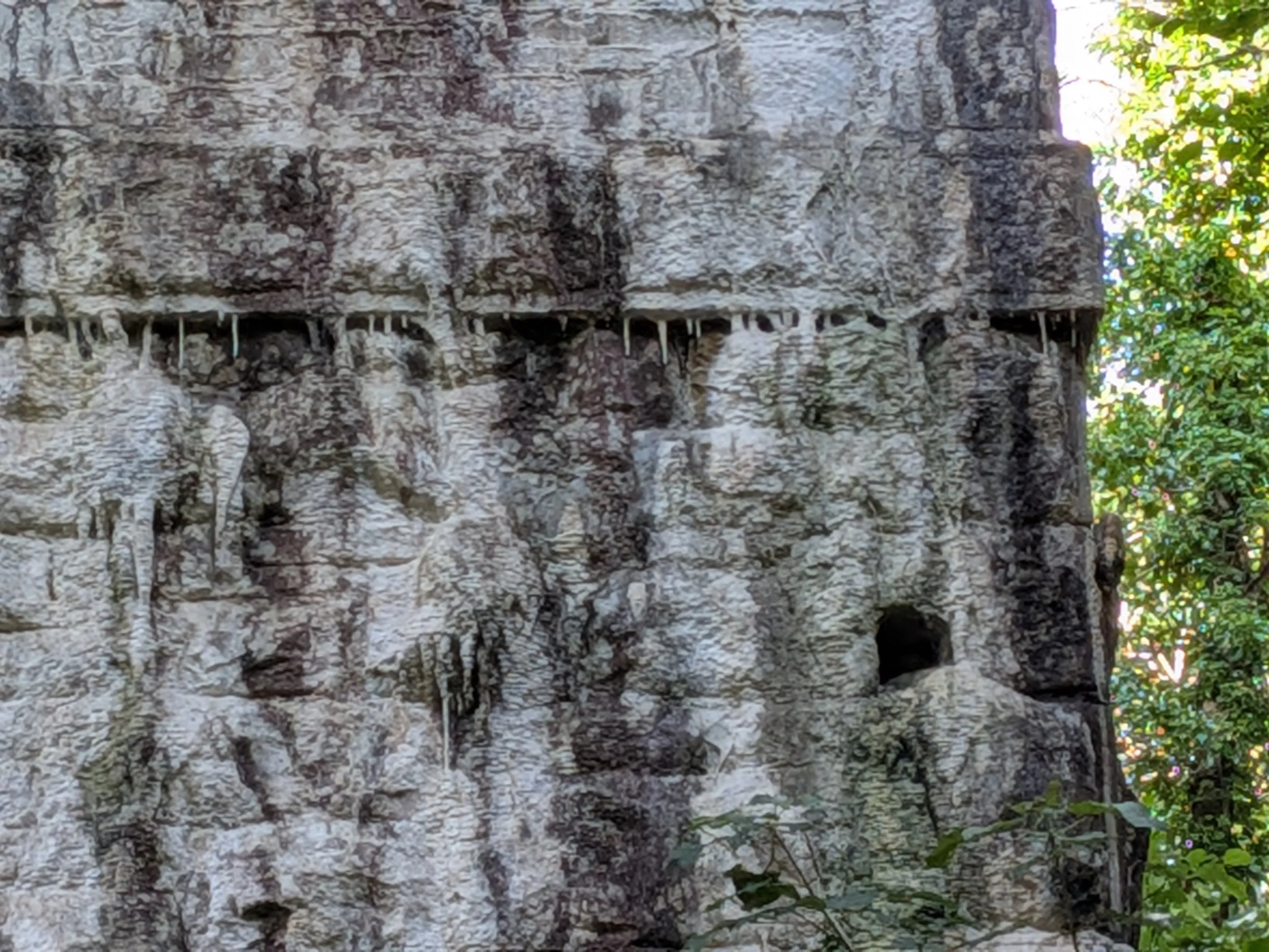
It's interesting that we have thick white staining under the walls, not in the gaps. The walls, presumably built with lime mortar, provide a source for more calcium carbonate, but I would expect the flow carrying that through the masonry to be greater in the gaps. Perhaps it is: if the flows are high enough, less will be deposited.
As we left, one area (right) caught my eye. Here we seem to have deeply eroded stone faces with mortar standing proud, suggesting that the stone is sacrificial to the mortar. Not what we would wish. I wonder whether this is original mortar or later pointing. The fact that it stands so far proud may indicate that it is original, as C20 cement pointing is rarely more than superficial.
It’s nice to see this structure back in use. In a sane world, we would be working at pace to extend this line to provide an alternative route to Plymouth and doing the work necessary to protect the main line at Dawlish. Sadly, our lords and masters seem more interested in made-up fiscal rules and building roads in the southeast than vital and low carbon transport links to the more remote corners of the island.